
AI Enabled Mission Management
SHOTOVER AIRSCAPE
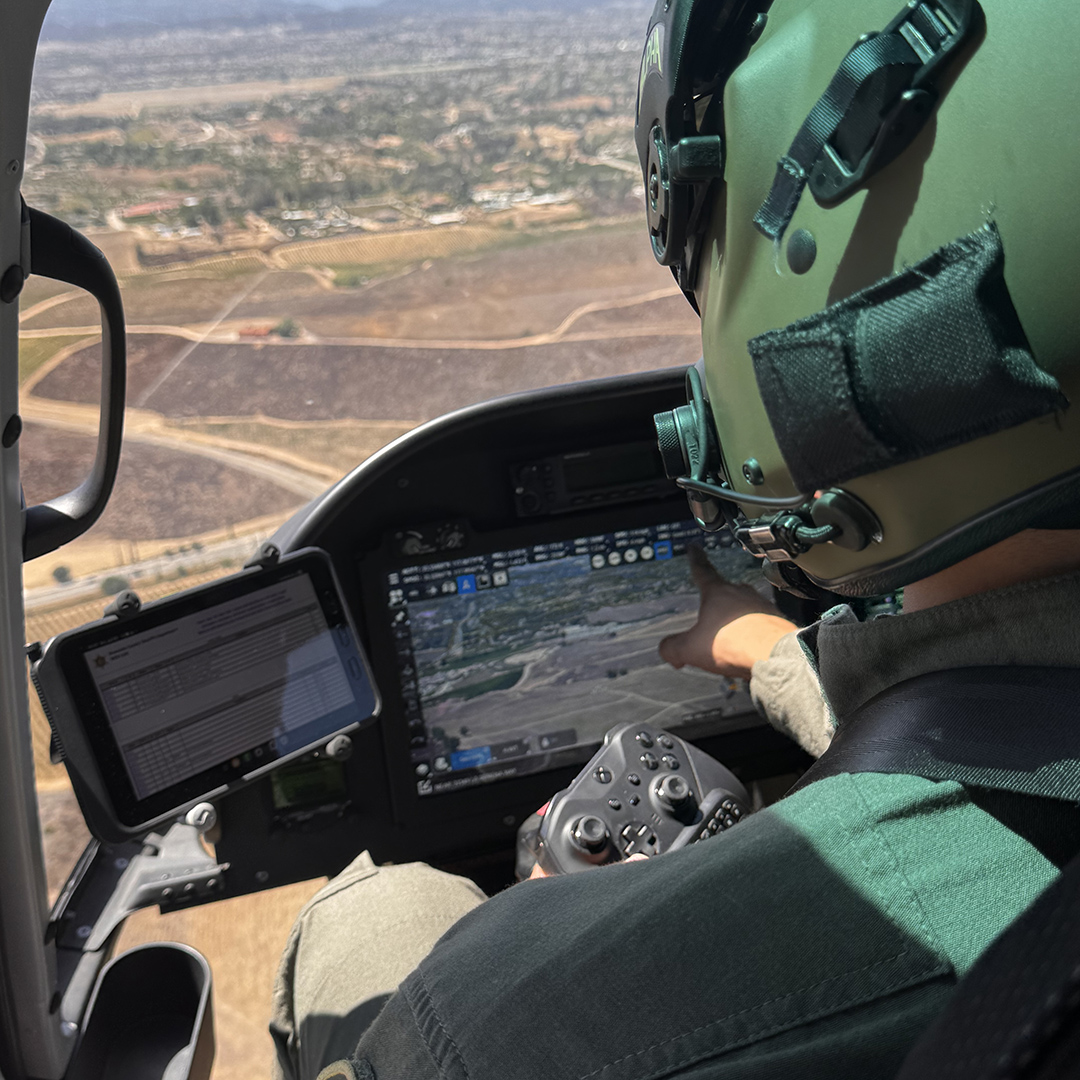
SHOTOVER’s next generation augmented reality software combines gimbal and camera control, mapping, and mission management into a single platform so operators can stay focused on the target. AIRSCAPE composites information such as street data, parcel information, business names, RADAR targets, AIS vessels, ground crew and vehicle locations, as well as additional custom data directly over EO/IR video in real time.
AIRSCAPE Features

Quickly identify street addresses, measure areas, calculate acreage, perform crowd size estimations, and even display a vehicle’s speed during fast-moving pursuits

High resolution aerial imagery and charts at your fingertips including: street data, topographic charts, digital elevation models, aviation charts, and custom supplied data

Artificial Intelligence (AI) Powered automatic target recognition for automated sensor operations and other tasks

View all flight information on one screen including waypoints and flight plans

Quickly search for airport locations, nearby aircraft, and other trackable vehicles

Interface to TAK and stream live video to Earthscape and other services

Place an unlimited number of geo-markers to highlight specific locations or landmarks
Keep up the pace with speed tracking of vehicles on land or water

Multiple orientation views provide unmatched situational awareness for perimeter mapping
SHOTOVER M2 Multi-Sensor System
Bringing many firsts to airborne ISR, the M2 Multi-Sensor system comes with SHOTOVER’s 5th generation, true 6-axis gimbal design and is the only EO/IR system that eliminates “gimbal-lock” and “horizon-rolling”.
Our Smallest and Most Powerful Mission Computer Yet
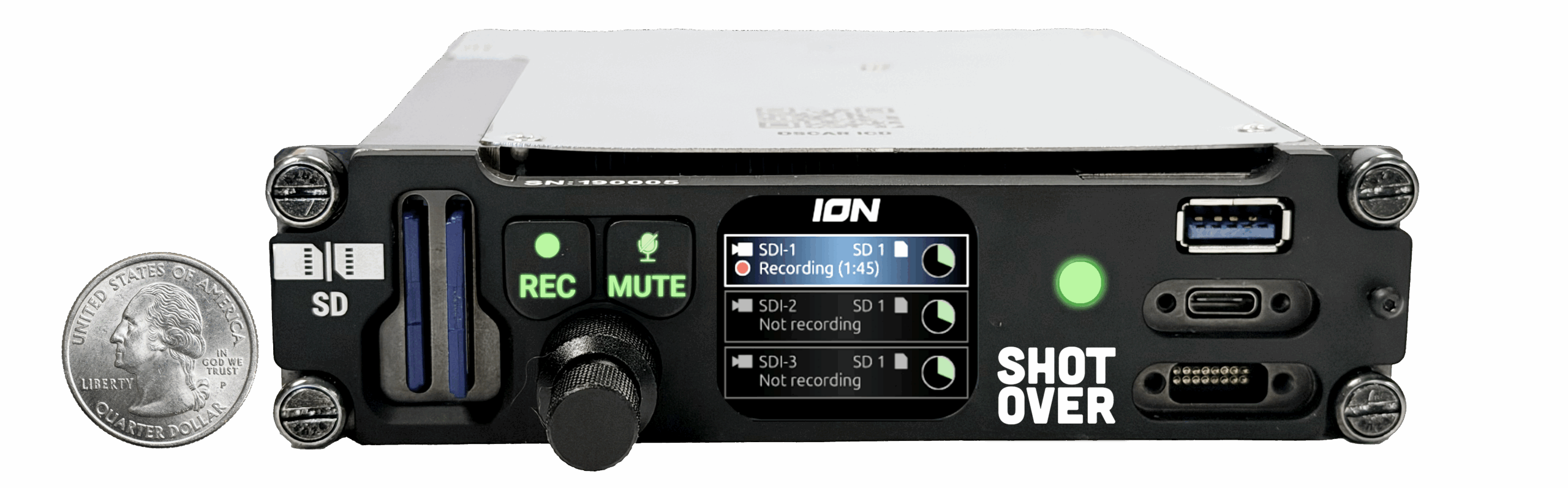
SHOTOVER’s M2 Multi-Sensor system is a complete mission solution with built-in 4K video and metadata recording, and an all-new version of our exclusive Augmented Reality System. Experience valuable information displayed as real-time augmented reality overlays for instant identification of street names, addresses, POIs – connect almost any data source to visualize weather conditions, aircraft traffic from ADS-B, ship locations from AIS, cell and radio emissions, friendly force locations, and more.
AIRSCAPE Specifications
input
Up to 4x 3G-SDI (1080p60)
OUTPUT
Up to 2x 3G-SDI + 1x Extra 3G-SDI outputs if only using 3x inputs
Interfaces
Front Connections
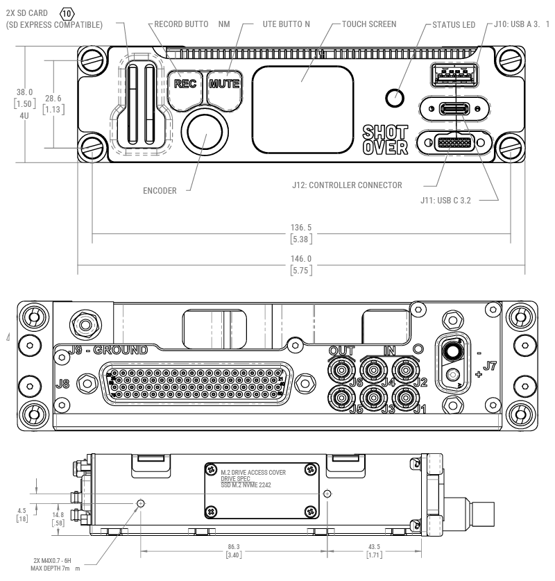
USB-A 3.1
USB-C: USB 3.2 + 20W PD + Ethernet interface
Gigabit Ethernet with 802.3bt 60W PoE
High-Brightness Screen
Rear Connections
Audio in (x2): balanced
Audio out (x2): unbalanced
RS232/RS422/RS485 (x3)
Gigabit Ethernet (x2): x1 is POE 802.3bt 60W capable
ARINC429: (x1 inputs, x1 output)
Wide Input Voltage Range (12-30 VDC)
CAN bus
USB 2.0 (x2)
PS/2 (x2)
GPIO (DI/DO/AI) (x6)
Storage
External - Continuous uninterrupted recording with Hot-Swap
Removable M.2 NVME 2242 SSD
Weight
2.54 lbs (1.15 Kg)
Size
6.02” L x 5.75” W x 1.5” H
152.9 mm x 146 mm x 38 mm
Certifications
DO-160G Certified (Sections 4, 5 ,6 , 7, 8 , 9, 15, 16, 17, 21, 25, 26)
NVIS MIL-STD-3009 compliant
ISO-9001
M2 Featured Video
M2 Launch Reel
M2 Featured Video
M2 Features
M2 Featured Video
M2 Customer Install
Featured Videos
SHOTOVER M2 In Action
Riverside County Sheriff's Aviation Unit shares how the SHOTOVER M2 is transforming their missions — from 4K clarity that reveals life-saving details to unmatched gimbal stability that locks onto the scene no matter what the aircraft is doing.
Explore Products

AIRSCAPE
Premier Augmented Reality Solution
Unsurpassed Situational Awareness
Pinpoint Locations & Targets

EARTHSCAPE
Video Management Made Easy
View Aircraft Flight & Camera Path
Secure Access From Any Location

ION 2
Multi-Chanel HD Video Recorder
Stream Real-Time Video
Playback & Review While Recording
Contact Request
Looking for a quote or have a question about our products? Fill out the form below and a SHOTOVER Systems team member will get back to you right away.